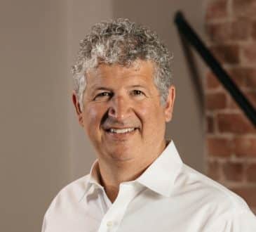
CEO Spotlight: Amir Farhand of Soar Talks About His Vision to Build the World’s ‘Living’ Map Using Drones and Satellite Imagery
The next evolution of mapping systems is upon us. That’s the message of Amir Farhand, the brains behind blockchain-based mapping platform Soar. The Australian entrepreneur and inventor are on a mission to build a “living map” of the world, one high-resolution image at a time. And he wants your help.
Soar provides a vast, continually updating repository of dynamic space- and airborne-based imagery. Think Google Maps – only bigger, sharper and fully decentralized, with everyday users incentivized to take part and engender improvements. Images derived from multiple data streams, including satellites, aerial imagery providers and individual drone operators.
What prompted your interest in mapping and compelled you to undertake a doctorate in Satellite Image Analysis and Earth Remote Sensing?
I’ve been fascinated with maps and geography since as far back as I can remember. When I was a child I would love reading atlases, old National Geographic magazines and then I’d take turns drawing maps on my parent’s walls! The first satellite image that I saw was the cover of a book on Earth Science when I was about 10 years old and I was convinced I wanted to be somehow associated with space, maps and earth science. After completing my undergraduate degrees in broader earth science disciplines, I decided to take my learnings and apply them on a more niche level with my postgraduate degrees which eventually led me to the use and applications of satellite imagery and data analysis. It was here that I discovered just how broad the applications of the discipline were, and the fantastic opportunities that lay within.
What was your experience of working with the Chinese government in the run-up to the 2008 Olympics? Were there any cultural or organizational challenges, and how was your work received by them?
The project was in conjunction with AusAID who have extensive experience and an incredible knowledge base of experts in a variety of disciplines. This really enabled better integration of co-working with other cultures and organizations, which was the case while working with the Chinese government. The Chinese have a highly hierarchical approach to their organizations; at first, we thought this would potentially be problematic, however, as we soon realized, culturally this worked exceptionally well for them, and it was a good opportunity for me to learn from them.
All in all, I found that in any mission, teamwork is required and people need to focus on their strengths to increase efficiency and maximize output. For example, even though there was an obvious language problem, we found that by using flow diagrams and sketches informal presentations, observers would be more able to understand the project outcomes. An added benefit of this was also the fact that a picture does indeed paint a thousand words, so using satellite images to communicate problems and outcomes was surprisingly easy.
How did the outcome of this work for the Chinese Government inspire you to start your own business, and what were the values and goals that it was founded on?
Going back to that statement, ‘teamwork.’ There are a thousand moving parts in these bigger projects, much like running a business, and good leaders have their fingers on the pulse as much as possible. It was a good way to learn how to fine-tune management and process in a project. At Takor, we aim to become one of the world’s leading mapping companies by creating state-of-the-art, easy to use and globally impactful technologies. Our values are based on not only making the experienced user-friendly but also building technology more people can use. We would rather have products that millions of people use than only a select niche. We want to be advocates for the greater geospatial industry and the many benefits that it provides. Additional values we instill here at Takor are leadership, attention to detail, humility and inclusion.
How quickly did your first venture grow, and what sort of duties were you involved in?
Our first product was Mappt, an Android-based field mapping technology that was originally created for offline use with mining companies in Australia. The product quickly evolved after we saw the many additional ways people were using it, including ranging from agriculture and environment through to logistics and security. We spoke at length to many users about what they wanted next, and this is what brought about the innovation of the Soar platform.
Starting out and in fact still, now, all of our staff are hands-on. Everyone needs to know how to use our software, the various datasets, their uses and of course understand the mission statement in helping build a super-map of the world. But going back to teamwork, you still need to attract the best talent for each position and we have been very lucky in establishing a terrific company culture which is actually more important than skills. Skills can be taught to the right person, but culture and the DNA of a company or mission are far harder to instill and promote.
What business lessons did you learn while building Mappt? How did it fit into the digital mapping landscape at the time in terms of competitors and what the technology could do in 2015?
It’s a good question. Back then everything was ESRI-centric. Jack Dangermond and his team at ESRI have done a terrific job developing digital mapping technology, however, we always thought that its uses still needed to be broader. Regular people have not heard of ESRI, but everyone has heard of Google Maps, and that’s what we wanted to emulate, we want to be the next evolution of Google Maps, not necessarily with Mappt but what would come after it. Mappt was solving a specific user requirement that mining companies were having, which had outgrown what ESRI could provide, not necessarily because the ESRI software wasn’t capable, but it was increasingly becoming complicated to deploy and use by the ‘layman.’
Another very important factor was the state of hardware technology. It’s sometimes easy to forget that the iPhone was launched in 2007 but even by 2015, the trickle-down simplicity of the iPhone was not available in most consumer and commercial grade mapping systems. But Android changed all this by allowing greater customization and optimization for both apps and hardware, so much so that now, the most cutting-edge mapping systems release to Android devices first, instead of iPhone or iPad.
Can you explain what drove you to found Soar, and elaborate on how it works for the average layperson?
The world’s maps and satellite/aerial images have a big problem. 80% of this content is found only through direct channels (i.e. through often enterprise or government levels services such as Maxar, Airbus and USGS). Meaning that currently not only is getting the right map data difficult but in most cases time consuming, inaccurate and expensive. There are petabytes of data out there that only a small fraction of people get to see and use. Imagine if we could unleash this to the masses and truly democratize its outputs? With Soar, we are creating the world’s first civilian mapping platform that is capable of map data viewing, analysis, and dissemination.
Soar doesn’t care where these maps and images come from, or indeed what type they are or who uses them. Our goal is to build a unified platform where users can access everything from near real-time satellite imagery, historical aerial imagery, archival topographic or geological maps and more all in one place. Think of it as a dedicated Google search meets Amazon, meets Google Earth, with the dissemination power of Dropbox.
How does Soar fit into a market dominated by Google Maps? What does it do that Maps doesn’t?
Google Earth and Google Maps have no doubt been tremendous fulcrums in the way we as a society interact with maps and satellite imagery. It’s been wonderful to see something that was so niche being expanded on and given to the hands of regular people. Only a company like Google could have done something like this. People should never underestimate the power of this technology and the democratization it has caused in the mapping industry. We don’t see Google as a competitor at all; in fact, you can access Google Maps base layers inside Soar. Rather, we see Soar as the next evolution of mapping systems that are driving the democratization of this technology further. You can compare it to the way the automobile industry has evolved, particularly in the last 5-10 years whereby the traditional prominence of ‘engine driven’ companies such as Ford, GM, and Toyota has evolved to the next stage of battery-powered smart cars such as Tesla. Soar aims to solve another big problem with maps and imagery – and that’s with regards to access, analysis, and dissemination.
Can you give some real-world examples of how and where Soar’s been utilized?
Since our launch in August last year, we’ve witnessed a large following of general users who have utilized our platform for its ability to search across a variety of different satellites. Be that regional-scale imagery provided by the likes of MODIS and HIMAWARI to monitor weather and wildfire events, through to more localized examples such as Sentinel-2 and Landsat-8 to specific land-use changes.
This isn’t totally surprising for us. Soar was created to be the platform for the world’s maps and imagery – meaning, every user with an internet connection and an interest in discovering their world is a potential Soar user.
With regard to industry-specific applications, the ability to search near-real-time imagery across a variety of multiple satellites is something that gives Soar an edge across other online offerings. We’ve fast become one of the world’s most ideal resources for journalism, and we’ve also worked collaboratively with investigative journalists to acquire the images they need for their stories.
In addition to mainstream media, we have a series of enterprise customers who require a custom offering that includes the ability to not only search satellite imagery but also view and share their own private maps and data. These customers are typically in industries that require the frequent use of maps, such as government, logistics, mining, oil and gas, and agriculture.
What are the main business lessons you’ve learned so far in your time as an entrepreneur?
First and foremost, you need to be solving a genuine problem. You need to, however, see how big your solution can get. Is your solution a feature, or is it part of a broader offering that can grow into an entire ecosystem? This leads to the topic of impact and its importance in scaling and mindfulness. From the very beginning of my entrepreneurial journey, I set my sights on not only driving innovative products and solving problems but also honing in on solutions with the greatest impact.
You also need perseverance, a lot of it. Being an entrepreneur is about getting rejected constantly, having no money, people giving you bad advice (often with good intentions) and riding that emotional rollercoaster of having a startup. Not everyone’s goals are aligned to yours and you are certainly not the center of the universe to anyone else except for yourself. Just because an investor rejects your idea, it doesn’t mean it’s not worth doing. You need to be able to just keep going.
And then there’s leadership: you need to be able to inspire, motivate and bring others on the journey with you. Good leaders are terrific communicators and can tell a narrative. An important lesson in being an entrepreneur is that you are always accountable, diligent but also have human qualities. Humility and leadership is something which I personally take extremely seriously and constantly relate it back to my entrepreneurial journey.
I also can’t express how important timing is. You can have the best product, but have it at the wrong time and no one will care. This also applies to deal with investors. Some are after a quick turnaround, while others have extremely patient timelines. You need to align yourself with those that are in sync with your own timings.
Of course, I can go on with the lessons I’ve learned, but this one should sum it up and end it nicely: having it all. The truth is you can’t have everything, not at the same time. You need to be able to prioritize. Unfortunately, these priorities can change back and forth often, but the more stable they are, the more chances you have of achieving your goals.
Have you read?
# Top 10 Best Bridges In The World You Need To See.
# Four Keys to Growing a Cybersecurity Company Through Acquisition and Beyond.
# Neutralizing Workforce Carbon Footprints.
# How to be a Chief Ecosystem Officer.
# 60 Most Innovative Countries In The World For 2020.
Add CEOWORLD magazine to your Google News feed.
Follow CEOWORLD magazine headlines on: Google News, LinkedIn, Twitter, and Facebook.
This report/news/ranking/statistics has been prepared only for general guidance on matters of interest and does not constitute professional advice. You should not act upon the information contained in this publication without obtaining specific professional advice. No representation or warranty (express or implied) is given as to the accuracy or completeness of the information contained in this publication, and, to the extent permitted by law, CEOWORLD magazine does not accept or assume any liability, responsibility or duty of care for any consequences of you or anyone else acting, or refraining to act, in reliance on the information contained in this publication or for any decision based on it.
Copyright 2024 The CEOWORLD magazine. All rights reserved. This material (and any extract from it) must not be copied, redistributed or placed on any website, without CEOWORLD magazine' prior written consent. For media queries, please contact: info@ceoworld.biz
SUBSCRIBE NEWSLETTER